Natural New England
The New England landscape, as we see it, is left from the age of the glaciers, but intriguing bits of older earth history poke through the glacial mess.
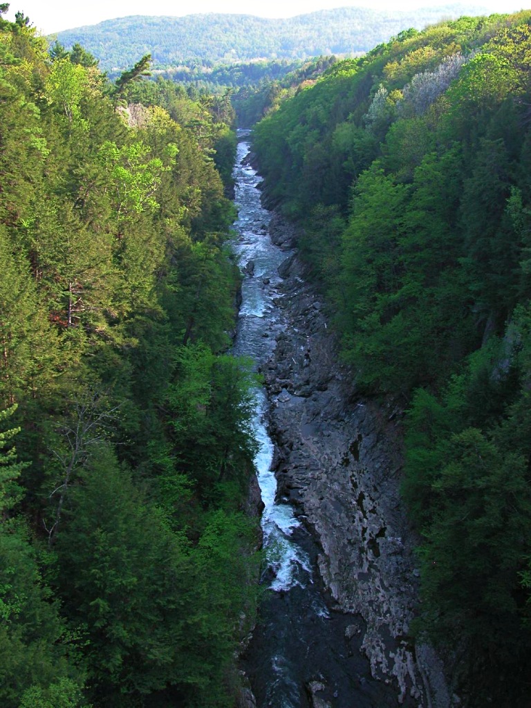
Quechee Gorge in Woodstock, Vermont, carved by glacial runoff when 200-mile-long (320-km) Lake Hitchcock drained 13,000 years ago.
New England Geology
New England's geology is an intriguing puzzle. The more pieces you recognize, the more you'll enjoy exploring the New England countryside.
Most of what you see is very, very young in geologic terms, the result of the recent glacial period about 18,000 years ago, when the Laurentide ice sheet extended southward from Canada over virtually all of New England.
(In geology, measured in hundreds of millions, even billions of years, 18,000 years is the merest millisecond. The prehistoric paintings in France's Chauvet Cave were already 18,000 years old when the Laurentide ice sheet crept over New England.)
The Glacial Moraine
At its southern limit the glacier dumped most of the soil and rock it had scraped up during its push southward, forming a ridge, or glacial moraine. Cape Cod, Nantucket, Martha's Vineyard, the Elizabeth Islands, Block Island, and New York's Long Island are parts of the moraine marking the southern extent of the glacier.
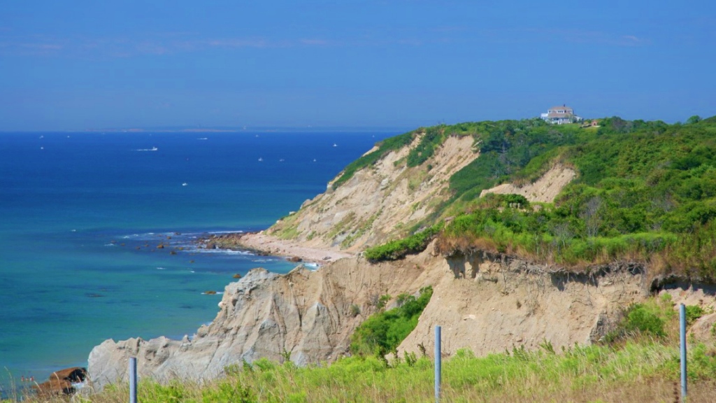
Mohegan Bluffs, Block Island RI: part of the glacial moraine.
Glacial Erratics
The landscape the glacier left behind in most of New England was a mess. Most of the soil had been scraped from it, and masses of rocks and stones gouged up during the glacial plowing were dropped helter-skelter.
The largest of these glacial erratics (rocks from distant geologic formations transported and deposited by glaciers) is the mammoth stone in Madison NH, south of Conway NH: 83 feet (25 meters) long, weighing 5000 US tons (4536 metric tons), but smaller glacial erratics may be found in any New England farmer's field. Thousands of them have been moved out of the track of the plow, to the fields' borders, to form New England's characteristic "stone fences" marking property boundaries.
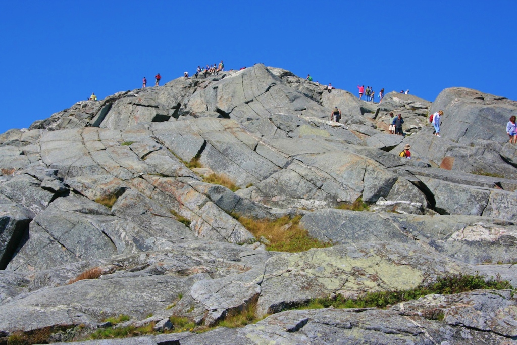
The Notches
The famous "notches" (gaps) in New Hampshire's White Mountains—Franconia Notch, Crawford Notch, Pinkham Notch—are U-shaped valleys ground out by glaciers moving through, as is Smugglers Notch north of Stowe VT.
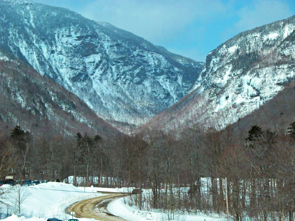
Smugglers Notch, near Stowe VT.
Tuckerman Ravine
Tuckerman Ravine, a glacial cirque (amphiteather-like scoop in a mountain) is a lively reminder of New England's ice age. Winter's ice lingers here into the summer months, and returns early in the autumn. I hiked to the summit of Mount Washington on the last day of August 1965 through snow, ice, and temperatures at the summit below freezing (32°F/0°C).
Drumlins & Eskers
The retreating ice sheet deposited and shaped its cargo of soil and stones into Boston's Bunker Hill, Breed's Hill, the Boston Harbor Islands and Dorchester Heights, oblong mounds of glacial residue called drumlins.
The ragged finger-like protrusions of land north and east of Maine's Casco Bay—the Harpswells, Bailey Island, the Boothbays—called eskers, were also formed by glaciers as courses of meltwater ran beneath the retreating ice.
Walden: a Kettle Pond
In some places, huge chunks of ice broke off the glacier, stayed put, and were surrounded by collars of sand and gravel running off the retreating glacier. When these landlocked icebergs melted, the holes they left, including the many ponds on Cape Cod, became kettle holes. Some such kettle ponds, like Walden Pond in Concord MA, have no streams flowing in or out (as they were not formed by running water). More...
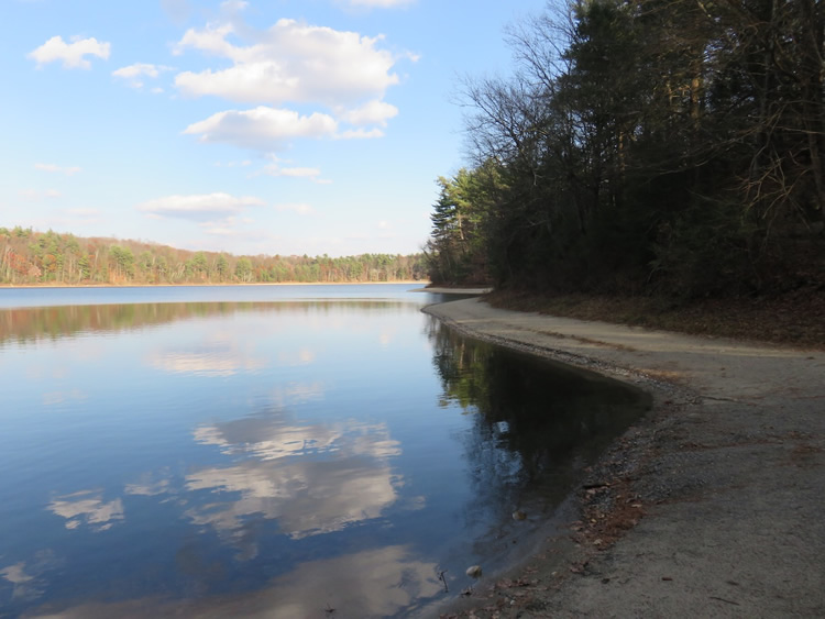
Walden Pond, Concord MA: a typical New England kettle pond.
Glacial Weirdness
Glacial oddities abound in New England. The glaciers—miles thick in places—depressed the land beneath so that when the ice melted the land was lower and the sea poured in to cover it. The St Lawrence River, connected to Vermont's Lake Champlain, was a broad inlet of the Atlantic for a time, inhabited by ocean-going creatures. This explains why, in 1848, railroad builders came upon the skeleton of a whale on dry land in a 10,000-year-old layer of clay in Charlotte VT, south of Burlington VT.
Though most of what you see as you travel around New England was formed by glaciers, in a few places evidence of much older geologic ages pokes through the glacial mess. The strongly-colored clays of Aquinnah (Gay Head) on Martha's Vineyard are a fragment of sediments from the Cretaceous Period (around 100 million years ago).
Dinosaurs!
Around 200 million years ago, before the mountains were given their final form, New England was in the midst of a tropical climate rich in plant life.
The Connecticut River Valley bears striking evidence of dinosaur life from the Triassic/Jurassic age. In fact, the first documented discovery of fossil footprints was in South Hadley MA in 1802. For the best displays of dino footprints, visit Dinosaur State Park in Rocky Hill CT, and The Trustees of Reservations' Dinosaur Footprints reserve in Holyoke MA.
Mount Monadnock
Speaking of "old," New Hampshire's Mount Monadnock, composed mostly of 400 million-year-old gneiss and schist, was hard enough to resist total destruction by the glaciers and, like the other New England inselbergs ("island peaks")—Mt Ascutney, Mt Greylock, Mt Wachusett—now raises its summit above the glacier-ravaged lowlands.
The summit of Mount Monadnock, New Hampshire.
Avlonia
That's also about the time that most of the bedrock in eastern Massachusetts, Rhode Island and southeastern Connecticut was positioned, part of a geologic feature named Avlonia, the western boundary of which is marked by the Lake Chargoggaggogg-manchauggaggogg-chaubunagungamaugg Fault (no joke) near Webster MA.
Vermont Marble
The beds of beautiful marble in the valley between Dorset and Brandon VT are even older, from the Paleozoic era about 500 million years ago.
Plymouth Rock
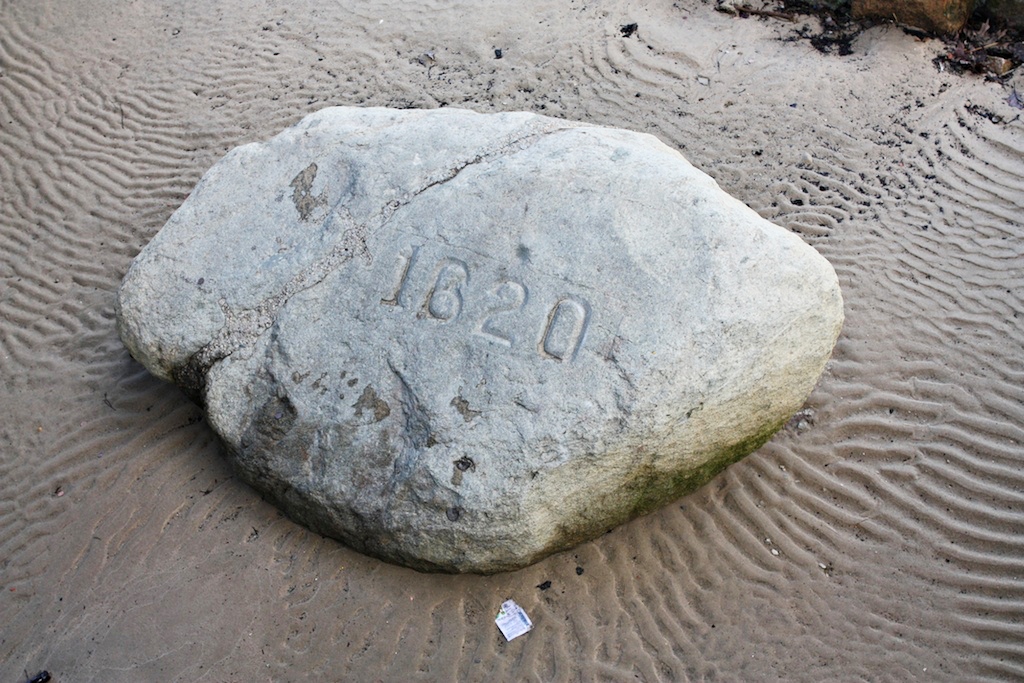
Plymouth Rock: originally from Africa!
Perhaps the most famous geological oddity, and among the oldest (680 million years), is New England's most famous stone: Plymouth Rock. The Pilgrims may have had a long journey from England, but the rock they supposedly stepped on when landing at Plymouth seems to have come from...Africa! More...
Flora & Fauna
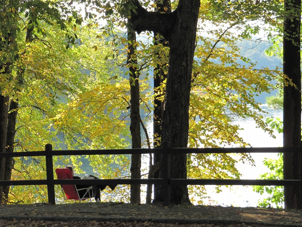
Enjoying the autumn foliage colors at Walden Pond, Concord MA.
New England has a varied landscape. Much of it is classed as New England-Acadian temperate broadleaf forest, with some boreal forest in the higher elevations. Because most of New England was early cleared of forest for agriculture and stock pasture, the resulting landscape is a mix of coniferous and northern hardwood regrowth forests, with alpine mixtures (tundra) near the summits of the higher elevations; and wetlands in the lowlands.
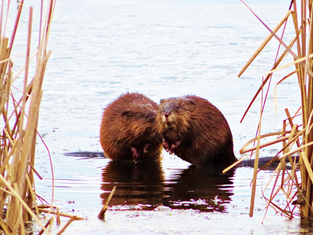
As for fauna, you may see American black bears, white-tail deer, eastern coyotes, red and grey foxes, lynx, pocupines, otters, fishers (sometimes called fisher-cats), muskrats, beavers, martens, opossums, turtles, raccoons, several varieties of snakes, wild turkeys, and birds using the Atlantic Flyway.